Lake Myvatn: The Sights, the Seasons and the Trips That Get You There
One shallow basin holds boiling mud, a lava labyrinth and the densest breeding duck population in Europe. Lake Myvatn sits 100 km east of Akureyri on Route 1, close enough for a six-hour day trip and rewarding enough for two days.
Lake Mývatn covers 37 km² of northeast Iceland at 288 m above sea level, an hour and a quarter east of Akureyri. The lava field that shaped it erupted about 2,300 years ago, and the sights sit in a loop around the shore: pseudo-craters, the Dimmuborgir lava formations, the Hverfjall crater, the boiling ground at Hverir and the geothermal baths now trading as Earth Lagoon. Nine guided day trips run from Akureyri, take 6 to 7 hours and cost $132 to $211 per person.
Key takeaways
Most reviewed: the BusTravel Iceland day trip at $181.05, rated 4.61 from 840 reviews, with a packed lunch and pick-up at the Akureyri port
Cheapest: the harbour tour from Soleil de Minuit at $132 for 6 hours, followed by the Arctic Adventures minibus at $134.37 and The Traveling Viking at $136.64
Highest rated: the 7-hour Fox Adventure trip at $210.66, rated 4.89, the only one that finishes with a soak at the baths
Every trip on this page takes no payment today and cancels free up to 24 hours ahead, which matters in a region where weather closes roads
Midges swarm the shore from June to August. Buy a head net in Akureyri before you go, or borrow one from the guide
Adult entry to Earth Lagoon, the baths formerly sold as Mývatn Nature Baths, starts at 7,900 ISK and the water sits between 36 and 40°C
Free cancellation 24h
Reserve now, pay later
Pick-up in central Akureyri or at the pier
Local guides, small buses
37 km²Surface of the lake
2,300 yearsSince the lava that shaped it
15Duck species that breed here
36–40°CWater in the geothermal baths
most reviewed
The Trip With the Longest Track Record
Akureyri: Lake Myvatn, Craters & Godafoss Day Trip
★★★★★★★★★★4.6(840 reviews)
Explore the North Iceland region of Myvatn, with its vast lava fields, volcanic craters, geothermal hot springs and mud pools. A packed lunch and pick-up at the Akureyri piers are included.
Duration
6 hours from Akureyri, about 3 hours of it out of the bus
Meeting Point
Gránufélagsgata 50 by the cruise piers, or the Visitor Center if your ship docks at Oddeyrarbryggja
Included
Packed lunch with a sandwich and juice, bottled water, WiFi on board, guide
Live availability for the 6-hour BusTravel Iceland day trip. Departures run daily through summer and thin out after September, when several operators switch to their winter schedule.
All nine leave Akureyri and reach the lake in about 75 minutes. They differ in what they add: a lava cave at Grjótagjá, a soak at the baths, a packed lunch, or a schedule timed against a cruise departure. Four of them are shore excursions timed against cruise arrivals. Prices below are per person in US dollars, taken from the operators' own pages.
from $181.05Most Reviewed — 840 Reviews
Akureyri: Lake Myvatn, Craters & Godafoss Day Trip
★★★★★★★★★★4.6(840 reviews)· 6 hours
The busiest Myvatn day out of Akureyri: lava fields, craters, mud pools and Godafoss, with a packed lunch and pier pickup included.
From Akureyri: Myvatn Lake & Godafoss Waterfall Tour
★★★★★★★★★★4.5(108 reviews)· 6 hours
Harbour pickup and the standard circuit: Skutustadir pseudo-craters, Dimmuborgir lava fields, the Hverir sulphur pits and Godafoss. Cheapest listing here.
Three ways reach the lake from Akureyri and one of them only half works. Route 1 runs east to Reykjahlíð in about 75 minutes, and road 848 loops the shore past most of the sights. What decides it is whether you have wheels once you arrive.
Way in
Season
Time
Book
Cost
Suits
Guided day trip
All year, fewer departures in winter
6 to 7 hours
$132 to $211 per person
Cruise calls, no car, first visit
Rental car on Route 1
All year, winter needs care
75 minutes each way
Fuel plus the rental day
Two or more people, own pace
Strætó route 56
Year round, a couple of runs a day
About 80 minutes each way
Bus fare only
Nobody in a hurry, staying overnight
Cruise shore excursion
Ship season, May to September
6 to 7 hours
$176 to $211 per person
Tight port windows, guaranteed return
Lake Myvatn by the Numbers
The shallowness is the thing to hold on to. Water this thin warms fast in summer, feeds a midge population no other Icelandic lake matches, and that midge population is what fills the shore with ducks.
288 mHeight above sea levelHigh enough that snow lies on the lava into May and the first frost arrives in September. Reykjahlíð averages 1.4°C over the year and takes 435 mm of precipitation, which is dry by Icelandic standards
4.5 mDeepest point of the lakeThe mean depth is 2.5 m. Sunlight reaches the bottom almost everywhere, which is why the lake bed grows the algae that everything else feeds on
1724Start of the Mývatn FiresThe eruption cycle ran to 1729, blew out the Víti crater at Krafla and sent lava through the farmland at Reykjahlíð. The Krafla Fires repeated the performance from 1975 to 1984
1,000 mWidth of the Hverfjall craterThe tephra ring stands about 140 m deep and roughly 2,800 years old. A marked path climbs to the rim in about 20 minutes from the car park on the west side
4,400 km²Protected conservation areaThe Mývatn and Laxá conservation area has held that status since Iceland passed its protection law, and the lake joined the Ramsar list of wetlands of international importance on 2 December 1977
15Breeding duck speciesThe densest concentration in Europe. Roughly 6,000 pairs of tufted duck and 1,500 pairs of greater scaup nest here, alongside Barrow's goldeneye, harlequin duck and red-breasted merganser
What You Are Actually Looking At
A Lake Sitting on a Rift
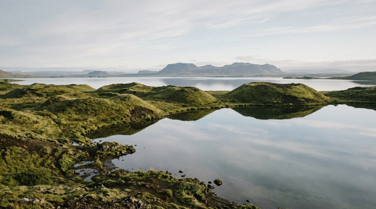
Iceland splits down the middle here. The North American and Eurasian plates pull apart across the Mývatn basin, and every few hundred years the ground opens and fills the basin with fresh lava. The current lake took its shape about 2,300 years ago, when the Younger Laxá lava poured down the valley and dammed the water into the outline you see today.
The result covers 37 km², reaches 4.5 m at its deepest point and averages 2.5 m. It sits at 288 m above sea level with about 50 islands and skerries scattered across it, most of them the tops of old craters. Sunlight reaches the bed across almost the whole surface, and that single fact runs the entire food chain: algae on the bottom, midge larvae in the mud, ducks on the water.
The river Laxá drains the lake north towards Húsavík and holds a reputation among fly fishers for brown trout and Atlantic salmon. Beats are leased through the local associations by the day and cost more than most people expect, so treat it as a planned trip rather than something you fit in between stops.
The Ring of Sights Around the Shore
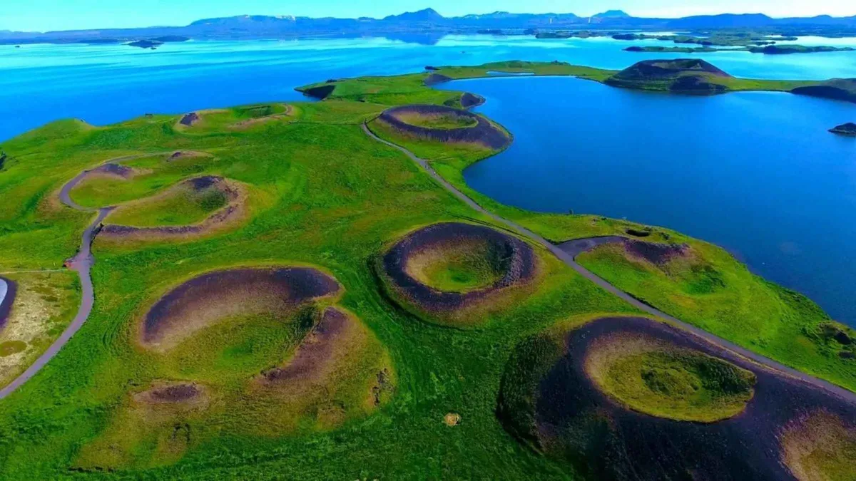
Road 848 loops the lake and links the stops in an order that works whichever way you drive it. Start on the south shore at Skútustaðagígar, where the grassy mounds along the water look like small volcanoes and are not. Lava ran over wet ground here, the water flashed to steam and blew rings of ash upward, leaving a pseudo-crater field with a flat 30-minute walking loop through it.
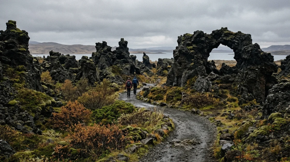
Dimmuborgir comes next on the east side: a collapsed lava lake that drained and left pillars, arches and hollow chambers standing. Trails run from a 20-minute circuit to an hour, and the Kirkjan arch at the far end is the one people photograph. Icelandic children know the place as the home of the thirteen Yule Lads, which is why the site fills with families in December.
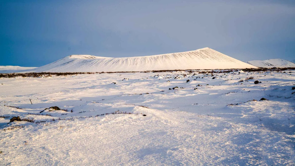
Hverfjall rises behind it, a tephra crater about 1,000 m across and 140 m deep, thrown up in a single eruption around 2,800 years ago. The path from the western car park reaches the rim in 20 minutes over loose black gravel. The rim walk gives you the whole basin at once, the lake on one side and the Krafla system steaming on the other.
Grjótagjá sits a short drive north, a fissure cave with a pool of clear blue water inside. Bathing there stopped in the 1970s when the Krafla Fires pushed the water to around 60°C, and the landowners still ask visitors to stay out. Entry and parking cost nothing. The cave picked up a second life as a Game of Thrones location, so expect company at midday.
Boiling Ground at Hverir and Krafla
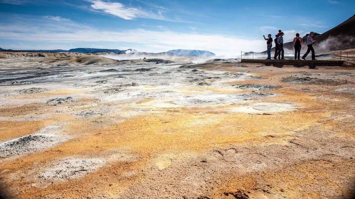
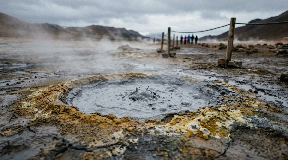
Cross the pass east of the lake on Route 1 and the vegetation stops. Hverir, the geothermal field under Námafjall, is bare orange clay with mud pools that thump like a slow heartbeat and vents that hiss steam at pressure. Ground temperatures run past 200°C a short way down, which is why the marked paths matter more here than anywhere else in the region. The crust looks solid and is not.
The smell reaches you before the car park does. Sulphur hangs in the air on still days, and it clings to clothing, so leave anything you care about in the vehicle.
Nine kilometres north the road climbs to Krafla, a caldera with 29 recorded eruptions behind it. The Víti crater at the top holds turquoise water and dates from the 1724 eruption that opened the Mývatn Fires. Leirhnjúkur, the lava field beside it, still steams from the 1975 to 1984 Krafla Fires and offers the most direct look at fresh volcanic ground anywhere near the lake. Snow closes the Krafla road into late spring, so check before driving up in May.
The Baths, Now Called Earth Lagoon
The geothermal baths at Jarðbaðshólar, east of Reykjahlíð, sold tickets as Mývatn Nature Baths for two decades and now trade as Earth Lagoon. Same water, same view over the basin, new name on the sign and on the booking page.
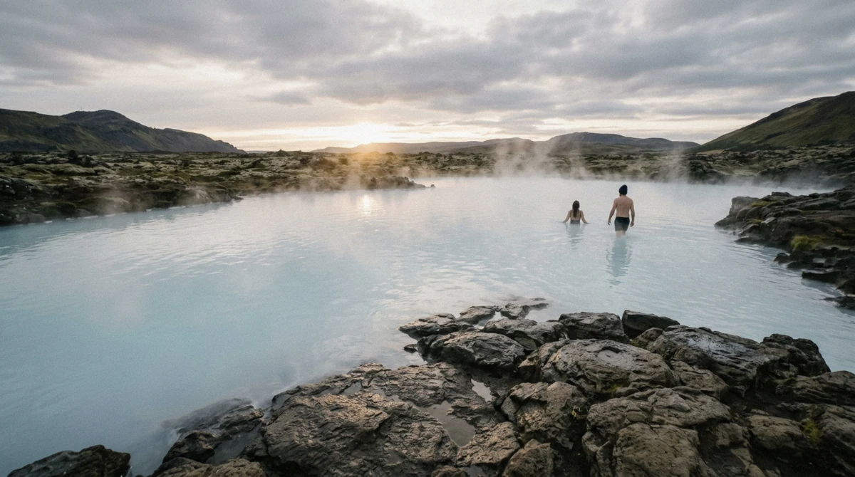
Water in the lagoon sits between 36 and 40°C, drawn from a borehole that runs at well over 100°C before it cools on the way in. Adult entry starts at 7,900 ISK, children of five and under go free with an adult, and towel rental runs 1,200 ISK if you travel light. Opening hours run 10:00 to 23:00, with seasonal variation at both ends. There is a steam bath built over a vent, a swim-up bar and a bistro looking out over the lake.
The late slot is the one to book between September and April. The lagoon faces north across open country with no town lights behind it, which makes it one of the better places in Iceland to sit in warm water and watch for aurora. One of the tours on this page finishes here, and if you are driving yourself it is worth the 6 km detour from Reykjahlíð.
Midges, Ducks and the Marimo Nobody Sees
Mý-vatn translates as midge lake, and the name is a warning as much as a description. Two species swarm here, one that bites and one that does not, and both hatch in clouds from the shallows between June and August. Numbers vary wildly from year to year. Some summers you barely notice them, others you walk from the bus to the viewpoint through a moving wall of insects.
A head net costs a few hundred krónur in any Akureyri shop and turns the problem into a footnote. Guides carry spares, and reviewers who mention the midges tend to mention the net in the same breath. Nora, who travelled in July 2026, put it plainly: the driver told her group that year's swarm was a third of the previous one, and she still recommended buying a net. They fade in late August and clear by early September.
Those midges feed the birdlife that gave the lake its protected status. Fifteen duck species breed around the shore, the densest concentration in Europe, with roughly 6,000 pairs of tufted duck and 1,500 pairs of greater scaup. Barrow's goldeneye lives here year round and nowhere else in Europe. Whooper swans, red-necked phalaropes and great northern divers fill out the list. The Ramsar designation from December 1977 and the 4,400 km² Mývatn and Laxá conservation area exist for them.
On the lake bed grow marimo, spheres of green algae that roll along the bottom and pack together in colonies. Researchers declared the population gone in 2013 after decades of decline, then found it returning. You will not see one without a boat and a still day, which is part of the appeal.
Goðafoss and the Diamond Circle
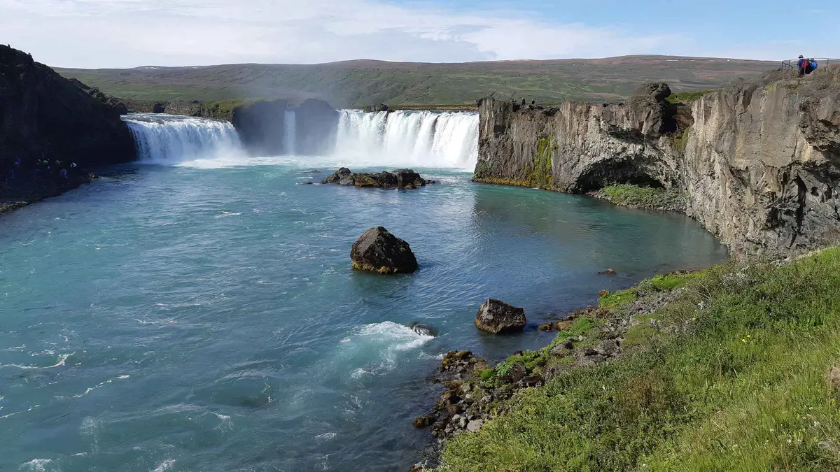
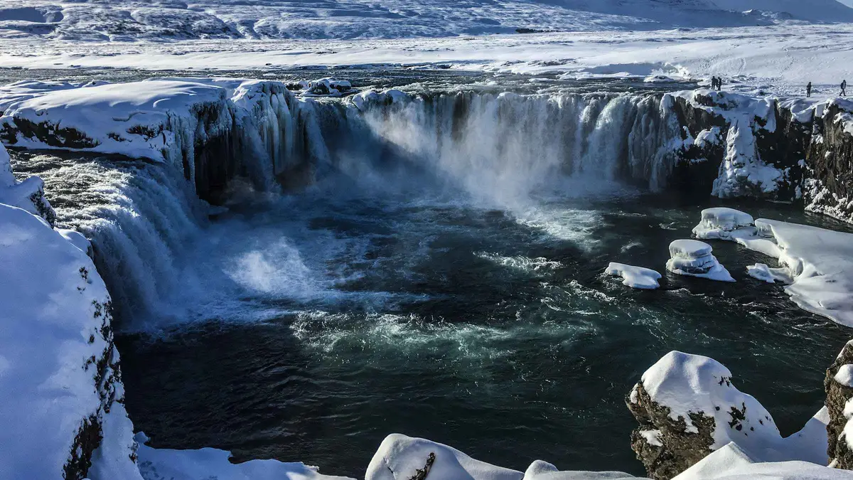
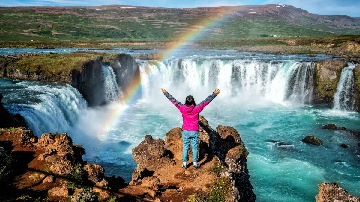
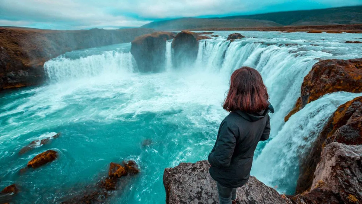
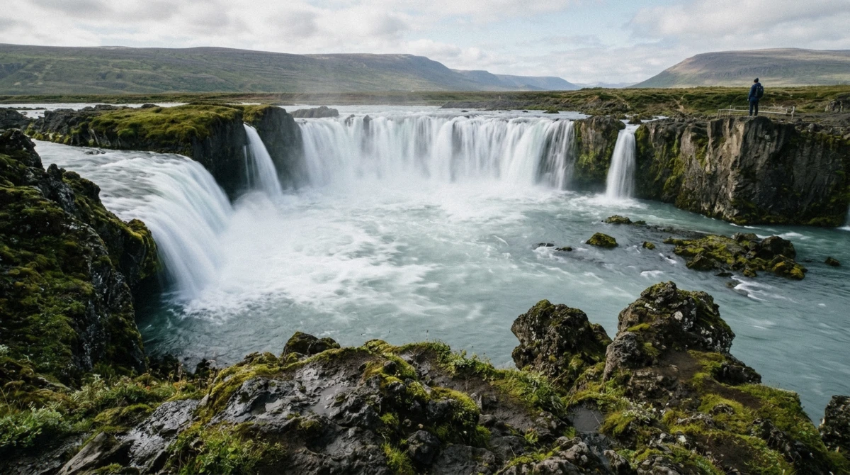
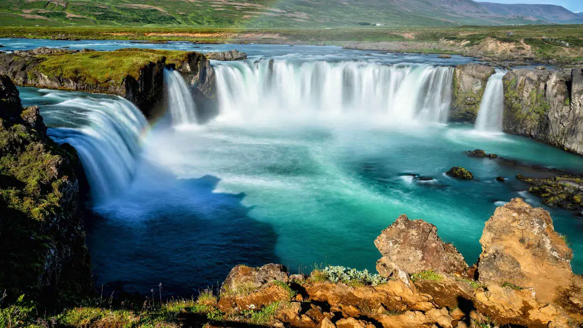
Every trip on this page stops at Goðafoss, and it earns the stop. The Skjálfandafljót river drops about 12 m over a horseshoe ledge roughly 30 m wide, right beside Route 1 between Akureyri and the lake. Paths run down both banks and the west side gives the better morning light. The name means waterfall of the gods, after the lawspeaker Þorgeir who threw his pagan idols in when Iceland adopted Christianity around the year 1000.
Goðafoss is also the western gate of the Diamond Circle, the northern route that strings together the waterfall, Lake Mývatn, Dettifoss, the Ásbyrgi canyon and the whale-watching harbour at Húsavík. Dettifoss lies about 50 km northeast of the lake, and Húsavík roughly the same distance north. Driving the full circle takes a long day from Akureyri and leaves little time at any single stop.
That gap is what the six-hour tours here are built around. They take the western half, Goðafoss and the lake, and leave Dettifoss and Húsavík for a second day. If you have only one day in the north, this is the half worth taking.
Getting There From Akureyri and Reykjavík
Akureyri to Reykjahlíð is about 100 km on Route 1, roughly 75 minutes without stops. The road is paved the whole way, climbs over one open pass and stays plowed through winter. Road 848 branches off to loop the lake shore.
From Reykjavík the drive runs about 480 km and takes 6 to 7 hours along the north coast, which makes it a leg of a ring road trip rather than a day out. The faster route flies: a 45-minute hop from Reykjavík to Akureyri, then the drive or a tour from there.
Without a car, Strætó route 56 between Akureyri and Egilsstaðir stops at Reykjahlíð. Departures are limited to a couple a day, the journey takes about 80 minutes, and the bus solves only half the problem. Once you step off at Reykjahlíð, the sights are spread over 30 km of road with no local transport between them. Fine if you have booked two nights and plan to walk or cycle. For a single day, a guided trip or a rental car is what works.
Cruise passengers have the simplest decision. Akureyri handles ships at Tangarbryggja and Oddeyrarbryggja, both a short walk from where the tour buses wait, and five of the trips here are timed against ship departures rather than a fixed clock.
How Long to Stay and When to Come
One full day covers the classic ring: Goðafoss, Skútustaðagígar, Dimmuborgir, Hverfjall and Hverir, with an hour to spare. That is the itinerary the six-hour tours run, and it delivers the region's greatest hits without rushing.
A second day buys Krafla and the Víti crater, the Leirhnjúkur lava field, Lofthellir, and either Dettifoss or the whales at Húsavík. Two nights in Reykjahlíð is the sweet spot for anyone driving the ring road, and it costs less than most people assume outside the July peak.
June to August gives you long light, every road open and every operator running. It also gives you midges and company at the car parks. September and early October trade the insects for autumn colour on the heath and the first aurora nights. From November to March the region turns quiet and white, the Krafla road closes, and fewer tours run, though the ones that do are the ones best equipped for it. The winter departure from Saga Travel holds 4.82 from 56 reviews, the strongest rating of the cold-season options here.
Weather at 288 m does what it wants. Reykjahlíð averages 1.4°C over the year and 435 mm of precipitation, with July highs around 14°C and January lows near minus 8°C. Wind is the variable that ruins days, not rain. Bring a shell, a warm layer under it and shoes that handle wet gravel, whatever the month says.
Lofthellir and the Cave You Need a Guide For
About 40 km east of the lake, under a lava field reached by a track no rental agreement covers, sits Lofthellir. The cave formed roughly 3,500 years ago when molten rock drained out of a lava tube. What makes it worth the trouble is the ice: columns and sheets that build up through winter and hold their shape into summer inside the cave.
Getting in means crawling through a narrow entrance, and getting around means crampons and a helmet. Operators run it from May to October with equipment included. It is the one sight in the region you cannot reach on your own, and the one that surprises people who thought they had seen everything the north offers.
Can You Swim in the Lake, and How Do You Say It
No, and two things stop you. The water averages 2.5 m deep, sits close to freezing for most of the year, and the shallows are thick with midge larvae. More to the point, the whole lake is protected under the Mývatn and Laxá conservation area, so swimming, boating and disturbing the shore are all restricted. The soak here is at Earth Lagoon, and one Mývatn tour finishes in that water after five stops on land.
The pronunciation trips almost everyone. Say it MEE-vaht, with the ý as a long ee and the final tn barely voiced. Goðafoss comes out closer to GOTH-a-foss with a soft th, and Skútustaðagígar is SKOO-tu-stath-a-gee-gar. Guides on every trip here will correct you with good humour, and most of them enjoy doing it.
Midges, Daylight and When the Tours Run
Bars show daylight hours at 65.6°N on the fifteenth of each month, and the figure underneath is the average daytime high at Reykjahlíð. The shaded band marks midge season, which peaks in the same weeks as the best weather.
4.6hJan-2°C
8.1hFeb-1°C
11.4hMar0°C
15.1hApr3°C
18.9hMay8°C
22.8hJun12°C
20.7hJul14°C
16.7hAug13°C
13hSep8°C
9.4hOct4°C
5.8hNov0°C
3.2hDec-1°C
Clear air, fewer departures, Krafla road shut
Midges thinning, aurora season starting
Midges swarming, every operator running
Northern lights need darkness, so the season runs September to April. Late June gives 22 hours of usable light and no aurora at all.
Where Lake Myvatn Is
In northeast Iceland at 65°36'N, 100 km east of Akureyri on Route 1 and about 50 km south of Húsavík. Reykjahlíð on the northeast shore holds the fuel, food and beds.
The Loop Around the Lake, Stop by Stop
Seven stops sit within 20 minutes of Reykjahlíð, linked by Route 1 and road 848. This is the order the day trips take them in.
Goðafoss45 km west on Route 1, before you reach the lake. About 12 m high and 30 m wide across a horseshoe ledge. Paths on both banks, free parking, 45 minutes is enough.
SkútustaðagígarSouth shore on road 848. Pseudo-craters blown out by steam, not lava. A flat loop of 20 to 30 minutes and the best duck watching on the lake.
DimmuborgirEast shore, 5 minutes from Skútustaðagígar. Lava pillars and arches with trails from 20 minutes to an hour. Café and toilets at the entrance.
HverfjallBehind Dimmuborgir. Tephra crater 1,000 m across and 140 m deep. Twenty minutes up the gravel path to the rim, longer for the full circuit.
GrjótagjáNorth of Hverfjall. A fissure cave with clear blue water inside. Bathing is not allowed and the water has run near 60°C. Free to visit, 15 minutes.
HverirEast over the pass on Route 1. Orange clay, mud pools and steam vents with ground over 200°C. Stay on the paths, allow 40 minutes.
Earth LagoonJarðbaðshólar, 6 km east of Reykjahlíð. Formerly Mývatn Nature Baths. Water 36 to 40°C, adults from 7,900 ISK, open 10:00 to 23:00.
Krafla and the Víti crater add 9 km north of Hverir and need their own hour. The road up closes under snow into late spring.
What Travellers Wrote After Going
★★★★★★★★★★
Petra and Robert did a great job. we learned a lot of the history of Iceland and each area we went to. They let us know about the Icelandic culture and background of each area and warned us about the bugs at the lake, though there was no avoiding them. enjoyed all 4 places we went and lunch on the bus away from the bugs. very reasonable compared to cruise excursions as well.
Rebekah · United States · June 2026
★★★★★★★★★★
Our guide, Michael, was very good explaining the sites and adding cultural information as we went. The trip was timed well so enough time to explore, not just photo stops. I liked that it was adapted as we went also. The sights themselves were great. Loved the geothermal area!!
Debbie · United States · July 2026
★★★★★★★★★★
Great tour we enjoyed it the only thing is a lot of flies but the driver said that amount of flies is nothing compare last time with triple the amount, make sure get a mosquito head net, but the tour the driver and the guide is really great.
Nora · Ireland · July 2026
Goðafoss sits 45 km west of the lake on Route 1, and every day trip on this page stops here. The west bank holds the light until early afternoon.
Reading These Trips Before You Book
Six hours, three of them outside
Every trip here spends about 150 minutes driving. What separates them is how the remaining time splits between four or five stops, so read the itinerary rather than the total.
Port pick-up is not hotel pick-up
Several of these are built for cruise arrivals and meet at the piers or the parking area on Gránufélagsgata. If you are staying in town, check the meeting point before you book.
Bus size changes the day
Minibuses reach the Grjótagjá car park and turn around in tight spaces that coaches avoid. Larger buses trade that for a smoother ride and a fixed route.
Lunch is rarely included
One operator packs a sandwich and juice. The rest stop at Reykjahlíð or the Dimmuborgir café where you buy your own, so carry cash-free payment and low expectations on choice.
Nothing at the sights costs money
Goðafoss, Dimmuborgir, Hverfjall, Grjótagjá and Hverir charge nothing to enter. You are paying for the drive, the guide and the seat, so compare on those three.
Winter departures are thinner
From November to March fewer operators run and the Krafla road stays shut. The trips that keep going in that window carry the highest ratings on this page.
The Eruptions That Built the Basin
Four events shaped what you drive through. The lake owes its outline to the oldest of them and its steam to the most recent.
About 2,800 years ago
Hverfjall
East of the lake
Event
One eruption
Crater
1,000 m wide
A single explosive event threw up the tephra ring that stands 140 m deep today. The crater has barely eroded since.
About 2,300 years ago
Younger Laxá lava
Mývatn basin
Type
Long fissure eruption
Result
37 km² lake
Lava filled the valley, dammed the water and set the lake's present outline. The pseudo-craters at Skútustaðagígar formed as the flow crossed the wetlands.
1724 to 1729
Mývatn Fires
Krafla system
Ran
5 years
Left
Víti crater
The cycle opened with the explosion that left the Víti crater and its turquoise water, then sent lava through farmland at Reykjahlíð. The church there survived it.
1975 to 1984
Krafla Fires
Leirhnjúkur
Ran
9 years
Record
29 eruptions on record
Nine years of rifting and fissure eruptions north of the lake. The ground at Leirhnjúkur still steams, and Grjótagjá lost its bathing pool to water near 60°C.
Nothing has erupted here since 1984. Krafla now runs a 60 MW geothermal power station on the same ground.
Questions People Ask Before They Go
Is Lake Myvatn worth it?
Yes, and the range is what makes it so. Inside one 37 km² basin you get boiling mud at Hverir, a lava labyrinth at Dimmuborgir, a 1,000 m crater you can walk the rim of, a cave with blue water and geothermal baths to finish in. Nowhere else in Iceland packs that variety into a 20-minute radius, which is the case made in full in is Lake Mývatn worth visiting. If you have a day in the north and no car, the 6-hour day trip from Akureyri at $181.05 is the straightforward answer.
Can you swim in Lake Myvatn?
No. The lake averages 2.5 m deep, stays near freezing outside high summer, and sits inside a protected conservation area where swimming and boating are restricted. The place to get in the water is Earth Lagoon, the geothermal baths formerly sold as Mývatn Nature Baths, where the water holds 36 to 40°C and adult entry starts at 7,900 ISK. Grjótagjá looks tempting and bathing there has been off limits since the water hit around 60°C in the 1970s. The minibus departures are the ones that stop at the cave.
How much time should I spend at Lake Myvatn?
One full day covers the classic ring of Goðafoss, Skútustaðagígar, Dimmuborgir, Hverfjall and Hverir, which is exactly what the six-hour tours here do. A second day is what Krafla, the Víti crater, Lofthellir and a run north to Dettifoss or Húsavík need. Two nights in Reykjahlíð suits anyone driving the ring road, and the where to stay guide compares the options.
How do you pronounce Mývatn?
MEE-vaht. The ý is a long ee, the a is short, and the final tn comes out barely voiced. It means midge lake, which tells you what to expect between June and August.
How do I get from Akureyri to Lake Myvatn?
Drive Route 1 east for about 100 km, roughly 75 minutes, then pick up road 848 to loop the shore. Strætó route 56 towards Egilsstaðir stops at Reykjahlíð in about 80 minutes with a couple of departures a day, though it leaves you 30 km from most of the sights with no local transport. The guided day trips solve that, run 6 to 7 hours and cost $132 to $211, and two of them collect you from your Akureyri hotel.
When are the midges worst?
June through August, with the heaviest swarms on warm still days near the shore. Numbers swing hard from year to year. A head net costs a few hundred krónur in Akureyri and makes the difference between a good day and a miserable one. The full packing list covers the rest. They thin out in late August and are gone by early September.
Can you see the northern lights at Lake Myvatn?
Between September and April, yes. The basin has almost no light pollution and often sits under clearer skies than the south coast. The late slot at Earth Lagoon, which stays open to 23:00, is the comfortable way to wait for them, and the winter departures run through the whole aurora season. Between May and August there is too much daylight to see anything.
Is there fishing at Lake Myvatn?
The river Laxá, which drains the lake north, is one of Iceland's best brown trout and salmon rivers. Beats are leased by the day through local associations and cost considerably more than a casual afternoon, and the lake itself sits under conservation rules. Arrange permits in advance rather than turning up with a rod.
Where is the best viewpoint over the lake?
The Hverfjall rim, 20 minutes up from the western car park, gives you the whole basin, the islands and the steam plumes at Krafla in one turn. For less effort, the low ridge above Skútustaðagígar looks north across the pseudo-craters and the water, and it is where the tour buses stop for photographs.
How far is Lake Myvatn from Húsavík and Dettifoss?
Húsavík, where the whale-watching boats leave, is about 50 km north. Dettifoss lies roughly the same distance northeast. Both belong to the Diamond Circle along with Goðafoss and Ásbyrgi, and both need a second day if you also want time at the lake.
Your guide
Elín Ragnarsdóttir
Guide, Akureyri and Mývatn · guiding the Route 1 run to Mývatn since 2014
Twelve summers of driving visitors east from Akureyri to the lake and back, and enough winters on Route 1 to know which forecast to believe. Carries spare head nets in June, checks road.is before coffee, and would rather send you to Hverfjall than let you queue at Grjótagjá at noon.
Ready to stand next to boiling ground? Compare the departures from Akureyri and pick your date.
 from $181.05Most Reviewed — 840 Reviews